パッケージ:
net.fishandwhistle.ctexplorer
ダウンロード:
50K
サイズ:
3 MB
Android 要件:
4.0.3 以上
アップデート:
2016年11月15日

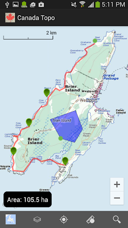


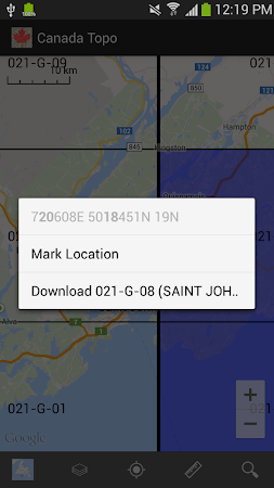

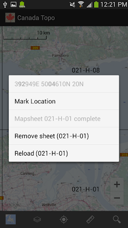
Canada Topo is designed to display the National Topographic System (NTS) grid for Canada and display topographic maps published by the government. It also acts as a basic GPS, offering tracking and waypoint functions as well as GPX/KML export.
コメント